thales:leila_gilberto_02032012
Essa é uma revisão anterior do documento!
Meeting 02/03/2012
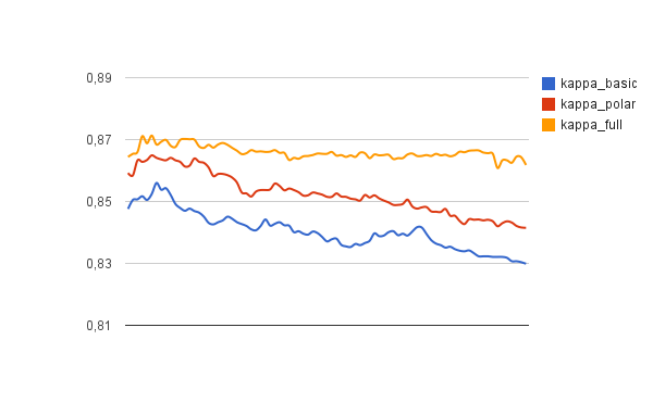
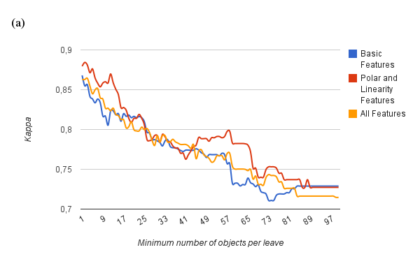
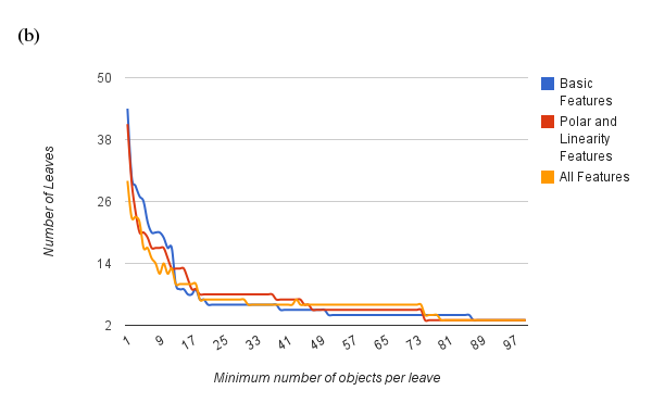
New results, using the seasonal feature of polygon area per quadrant
Typology based on MOD12Q1 (Water, Evergreen Broadleaf forest, Deciduous Broadleaf forest, Open shrublands, Woody savannas, Croplands)
Typology (Single crop, Double crop, other classes)
Using a combination of features (Basic + Polar), 90% of correct classified points (2074 instances).
Results presented in paper
Basic features X Polar Features. Typology (Single crop, Double crop, other classes)
TerraClass (2008) X GeoDMA (growing season 2007-2008)
scene 22469 with 58110 points, and 72% of correct classified points.
scene 22670 with 13629 points, and 85% of correct classified points.
scene 22768 with 83861 points, and 81% of correct classified points.
scene 22969 with 10890 points, and 15% of correct classified points.
scene 22769 with 60286 points, and 77% of correct classified points.
scene 22668 with 65784 points, and 63% of correct classified points.
scene 22770 with 29331 points, and 31% of correct classified points.
scene 22669 with 97752 points, and 77% of correct classified points.
Thesis
First Version
1 Introduction
- 1.1 Scientific Question and Hypothesis
- 1.2 Contributions
- 1.3 Document Organization
2 Review
- 2.1 Landscape Ecology
- 2.2 Object-Based Image Analysis
- 2.3 Data Mining
- 2.4 Multitemporal analysis
3 Method
- 3.1 Defining the input data
- 3.1.1 Segmentation
- 3.1.2 Cycles detection
- 3.2 Feature Extraction
- 3.2.1 Segmentation-based
- 3.2.2 Landscape-based features
- 3.2.3 Multitemporal
- 3.2.3.1 Basic features
- 3.2.3.2 Linearity features
- 3.2.3.3 Features based on polar representation
- 3.3 Data mining to detect land change
- 3.3.1 Building a reference set
- 3.3.2 Classification using decision trees
- 3.4 Output
- 3.4.1 Measuring change
4 Results
- 4.1 Land cover using intra-urban imagery
- 4.3.1 Input dataset
- 4.3.2 Experiment
- 4.2 Detection of patterns of the urban landscape
- 4.3 Classification of agriculture cycles
- 4.4 Evaluating the new multitemporal features
5 Conclusion
Alternative
1 Introduction
2 Paper GeoDMA
3 Paper Polar Features
4 ???
5 Conclusion
thales/leila_gilberto_02032012.1330708842.txt.gz · Última modificação: 2012/03/02 17:20 por tkorting


